


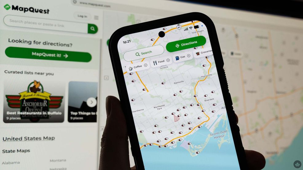
MapQuest returned to the cultural zeitgeist earlier this year when it rejected U.S. President Donald Trump’s push to rename Lake Ontario. Now it’s making headlines for displaying the location of surveillance cameras, at the request of users.
MapQuest now has a ‘surveillance layer’ that users can enable, which displays an animated eye where there are automated licence plate readers (ALPRs).
The move comes amid increasing scrutiny of cameras like ALPRs, which some consider a growing privacy concern. While police view these cameras as tools for finding criminals, stolen vehicles, missing people, and more, the public has valid concerns about misuse.
This is particularly true in the U.S., where ALPRs from companies like Flock are increasingly being used for predatory behaviour, from pulling over innocent people to stalking people and recording children. And that’s not even getting into how the White House is leveraging these cameras for widespread surveillance.
Per CBC News, MapQuest’s camera markers include Flock cameras as well as those from other companies, including Genetec, PlateSmart, Neology, and Verkada. Additionally, the camera locations come from crowd-sourced data from OpenStreetMap.
Of course, MapQuest isn’t the only one mapping these cameras. Several other tools have cropped up for mapping ALPRs from Flock and other companies. There’s panopti.ca, a Canada-focused, open-source ALPR mapping tool, which is built on top of DeFlock, a similar tool for the US. Another similar website is called flockcameralocations.com.
 News
 News
 Gaming
 News
