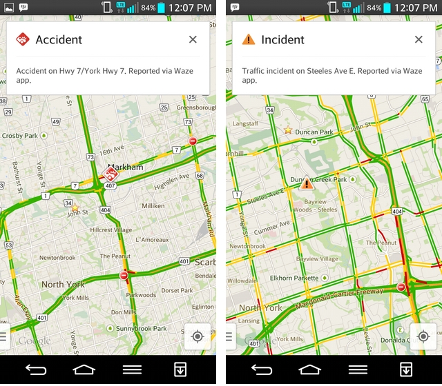
When I opened Google Maps this morning, I saw a number of small familiar-looking icons dotted across the virtually-busy streets of Toronto. Tapping on one alerted me to an accident; the other, a road closure. And the data was all provided by Waze.
When Google purchased Waze for $1 billion earlier this year, it was impressive to see how quickly the company integrated the Israeli startup’s crowdsourced traffic data into its own Maps app. But the initial rollout was limited to only a handful of countries, and Canada was not among them.
Today, Google is rolling out traffic incident data, provided by Waze, to 46 countries, Canada included. Tapping on the Traffic overlay on iOS and Android brings up the familiar green, yellow and red lines (in Toronto, more red than anything else), along with icons denoting user-submitted traffic snarls.
Of course, merely informing you of an accident isn’t good enough — or Google enough. The app will dynamically plan your course based on known delays, and if an accident occurs while you’re travelling, the app will alter your route accordingly.
Pretty cool stuff, and no update needed.
[source]Google Maps[/source]